|
Dates: June 23rd - 25th by Christian Veenstra 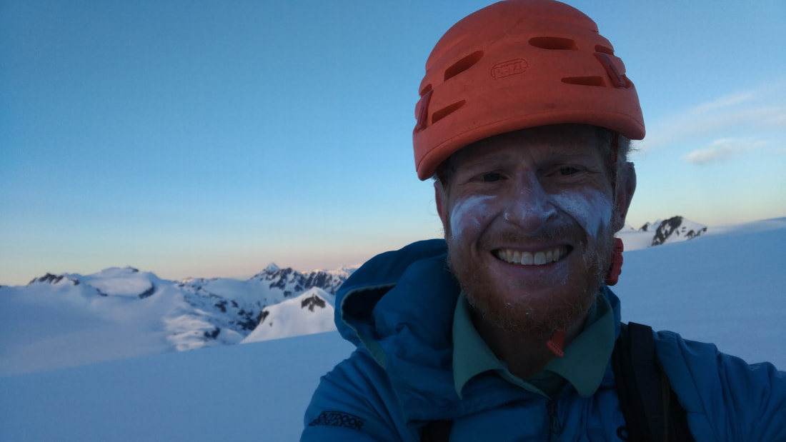 Dawn on the Misty Icefield Traverse. This is part two of my solo ski trip around Garibaldi Park, accessed self-propelled from my doorstep via Pitt Lake. Read all about getting there here, getting back home here, or continue to read about the skiing portion.
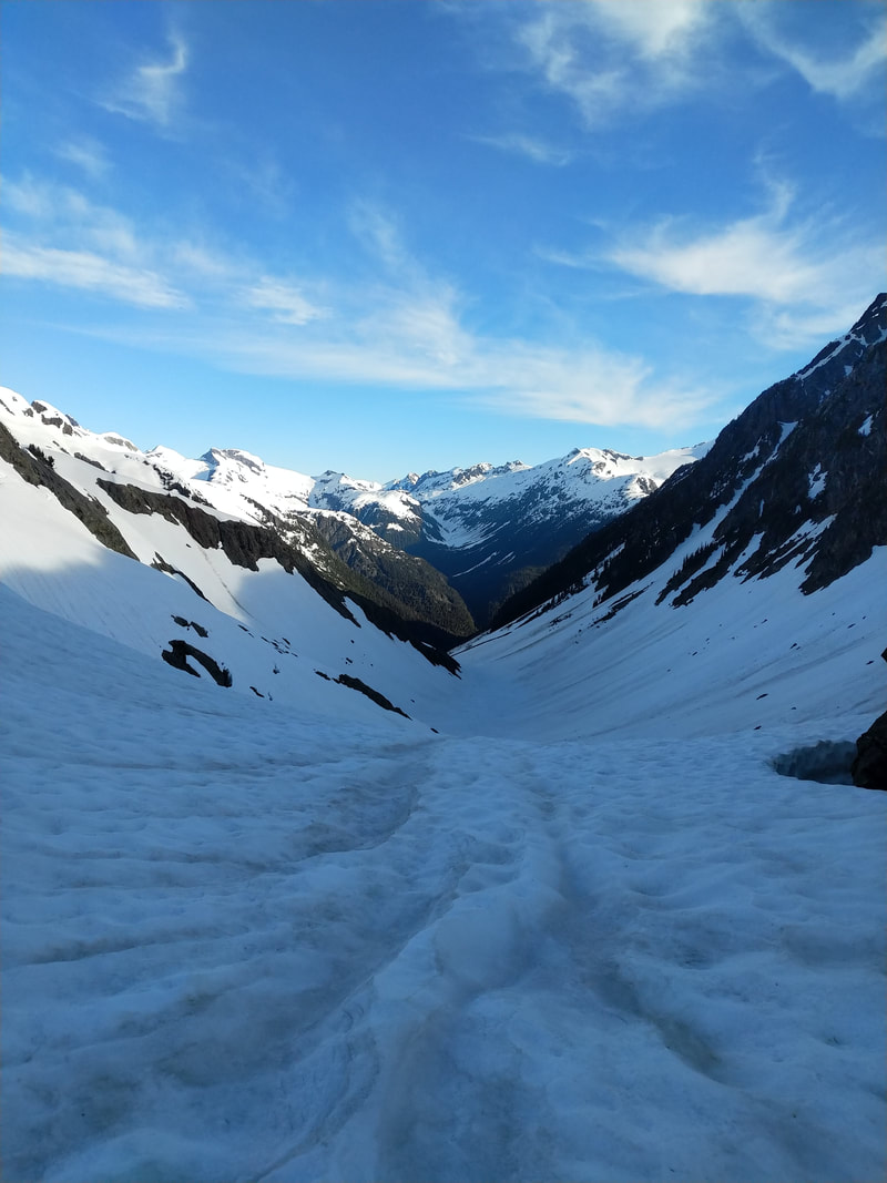
Although I knew all the distances the logging roads road approach is longer, emotionally, than I expected. I mean, I was just riding a bicycle and now I'm clomping along in ski boots. Also, I don't want to start running and trash my feet just yet. Probably I should have brought shoes. The upper spur I take is overgrown and a bit of a bushwhack, but nothing atypical for ski mountaineering on the coast. It does slow me down substantially, though, which has a snowball effect as it eats away into the precious night when the snow if firm. Once it starts getting bad I try and leave the road at the first hint of snow, but eventually regret it and end up back on the road higher up. Still I can't complain - I do have complete snow coverage by the top of the road (despite the fact it's late June) and am heading into mature forest up the shoulder of Katzie just before 11 pm. Once into the mountains and on my skis my pace quickens, at least when I'm not figuring out where to go. The night and sliver of a moon makes for more interesting navigation, as I haven't seen any of this terrain before, but overall things go smoothly - there are slight deviations for local features (crevasses, rock bands, etc.) but I hit my planned route spot-on with very little second-guessing. 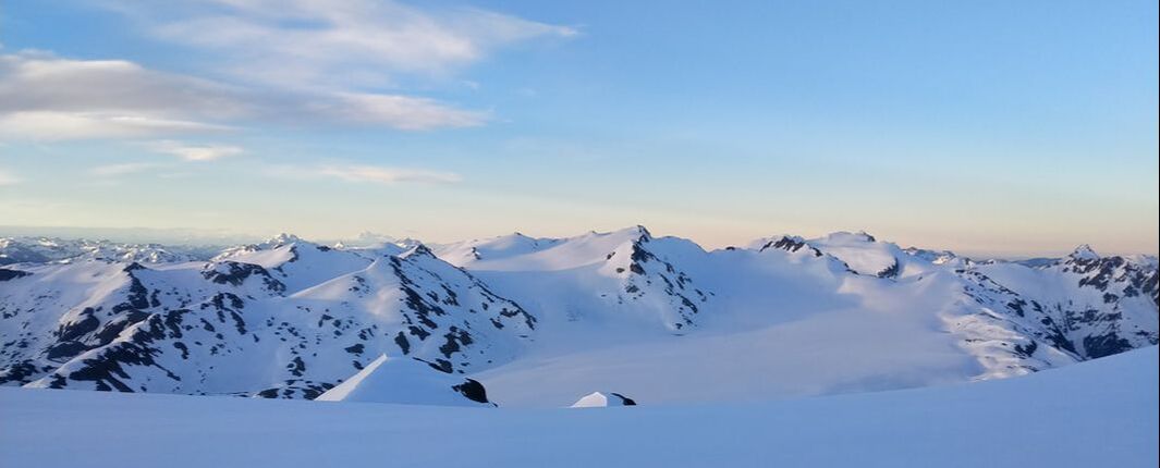 Looking back over the Misty Icefield from near Snowcap Peak. I came over the col between Stave Peak (high point near centre) and Misty Peak (rocky peak just to Stave's right) after coming over the shoulder of Katzie Mountain (high point on the skyline behind and to the right of Misty). Conditions are great - the sky cleared just as things cooled off for the evening and the snowpack firmed up with a fast icy crust. I'm making good use of not only my ski-crampons but also my new tech-fitting crampons (I've received no compensation here but, seriously, if you are thinking about getting these things just do it - they are as awesome as you imagine) on the ascents and my freshly-sharpened edges on the descents. I can't realistically imagine faster progress over this unfamiliar terrain with the interesting exception of the Misty Icefield itself - I'd planned on skating this big, flat, glacier but found it to be riddled with the largest suncups I've ever experienced (or, of course, if I had tracks to follow... but I prefer no tracks anyway). I would discover this to be a general problem with a lot of the mid-elevation flat terrain in the area - you could basically drop a pumpkin anywhere on that glacier and it would fall below the upper lips of these abnormally large suncups. Not only was skating impossible, but even skinning was tricky - every once and a while a ski tip would submarine into the far side of an icy suncup and the ski would instantly stop causing a pretty sudden stop and (usually) crash. I wonder if it was from the absence of any warm temperatures during May followed by it all of a sudden being late June. Dawn breaks before cresting the shoulder of Snowcap Peak and I rip some more great low-angle tele turns down the side of the Thunderclap Glacier towards Snowcap Lake. 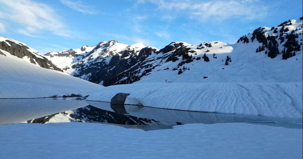 The outlet of Snowcap Lake, with the col to Tuwasus Creek in the background on right.
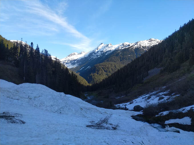 End of the (snow) line. But salvation (the mature forest) isn't far off. 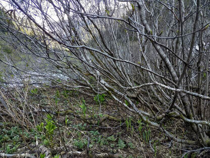 The slide alder bushwhacking in Tuwasus Creek was typical. The slide alder bushwhacking in Tuwasus Creek was typical. Eventually the snow does peter out, but I make it almost to the low-point first and while there's a fair amount of alder it's overall nowhere near as bad as I expected. I do "transition to bushwhack" (take the dangly things like crampons off my pack and strap my skis and poles into a single item I carry in my hands) and soon enough it's over and I've made it through to mature forest. I've only tried them twice, but I think skimo races would be more interesting with a bushwhack section/transition. I guess they descend from a European, not coastal, ski-mountaineering tradition. There's logs everywhere by the creeks - I don't even need to look around and have got my pick for crossing all the branches of Tuwamus creek. It's no speed traverse pace, but I make good time through the mature forest and manage to weave my way underneath cliff bands heading NW from the 4-way junction of various Tuwasus Creek branches. This isn't the typical way to link the Misty to the McBride, but I'd spotted a low bench on the toe of Mist Door on the map during planning and figured that making for it would keep the bushwhacking to a minimum and get me back on my skis quicker. The bench turned out great early on, and I did have my skis back on fairly quickly, but it ended up becoming a bit broken and indistinct later. The trees were also a bit thicker than I'd hoped, leading to a reasonable amount of micro-terrain problems and second-guessing. There was also a bit of a canyon in the way where I'd planned to start heading up towards Forger and the McBride... Having not gone any other ways it's tough to say what's best, but I was satisfied overall with the linkup and about 5.5 hours later (just after noon) I was done with the forest nonsense and back into bigger terrain slogging it up towards the Snow Bowl Glacier. I was very happy to find that the snow was still pretty firm despite the lateness of the hour, perhaps too happy as I skipped out on my original plan and just started slogging straight up, which actually put me a little too high and I had to loose a bit of elevation to get back on course. 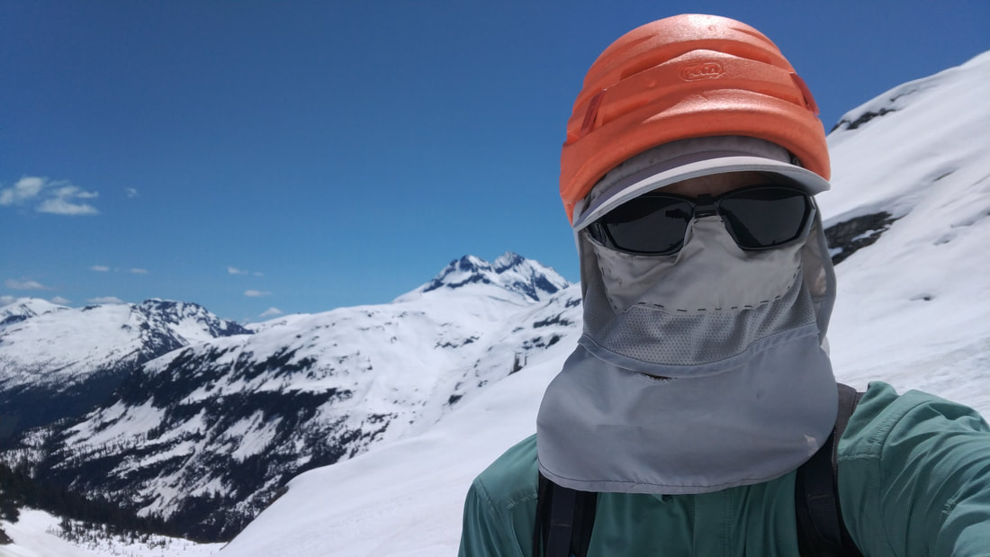 I love my "invisible man" hat. A selfie-glance back towards the "bench" (lower left, in the forest below the cliffs) as I climb up towards Forger. Mount Pitt is the dominant peak in the distance; I basically went around it. Back on the normal McBride route I wasn't surprised that it was, yet again, tricky to find the best line around the North side of Fake Peak. It seems like it should be easy - just a big round glacier with the odd crevasse, but I'm pretty sure I gained more elevation than strictly necessary. This would be the 4th time I've passed by this mountain... maybe next time I'll get it right. I picked up water at the small lake just before Drop Pass and then pulled another deviation from the regular route - rather than skiing over Sinister Ridge (which I consider the crux of the McBride) I tried dropped down into the valley and skied back up the shoulder of Hour/Isosceles, linking together bumps and lumps to get back on the big flat glacier above. I'm not sure which is easier, actually - I was hoping for just a slog, but there where a lot of choices to make in those bumps and lumps. Also there was a lot of pollen on the snow lower down, leading to skin adhesion problems when it came time to head back up. Crossing behind Isosceles to punch through Crosscut Ridge beside Mount Luxor I remembered it being a lot less of a steep sidehill... more second guessing, more time. Maybe the glacier is receding, or maybe my memory is just bad. By the time I was dropping towards Gray Pass the heat of the day was really starting to weigh in as well - I didn't know it but a heat warning was issued for the lower mainland. Rather than starting to cool off towards evening it just kept getting warmer. The snow got sloppy and wet, and so did my feet. Dropping down the valley from Gray Pass I'd climb back up the Pike Glacier and hook towards the Neve - another deviation from my previous trips when I went via the Phoenix Glacier and passed on the other side of the Glacier Pikes. I'd hoped that cutting the corner would save a bit of distance and time at the cost of elevation, but I'm not sure it worked out that way - the mushy snow made the ski down slow and inefficient. Additionally more low-elevation pollen, and now thousands of iceworms who'd come to the surface in the evening, deposited a lot of gunk on my bases and my climbing skin adhesion wouldn't recover for the rest of the trip. Of course my repair kit contained ample Voile straps, so I could strap them on, but it's not really the same. Oh, and "contouring" around the South side of the Glacier Pikes to the Sharkfin col? Yeah, that looks way better on the map. There are numerous landslip features with steep transitions that are actually pretty tricky to ski across efficiently. I tried comparing times to my 30.3 hour North-South speed traverse of Garibaldi Park for these sections, and it doesn't make the value of these two route modifications clear - I was slightly faster between the Snow Bowl Glacier and Drop Pass this time around (identical route), and only 6 minutes slower getting from Drop Pass to passing behind Hour Peak (dropping into the valley instead of taking Sinister Ridge). I lost basically an hour on my old time getting to Gray Pass from there on an identical route, though, which I think was mostly due to the snow becoming totally mushy (and some time spent second-guessing my location). I lost another hour on my old time getting to the high point of the Garibaldi Neve via the Pike (rather than Phoenix) Glacier, but at least I did hit the highpoint bang-on even though it was now completely dark (I've lost count of how many times I've crossed the Neve, in good weather and bad, although I forget if I've done it in the dark before). At the Neve Highpoint I had another decision to make - skiing out via Elfin Lakes / Red Heather would be a good bailout option. Perhaps the only realistic bailout option of the trip. My feet were starting to feel the effects of getting soaked coming out of the McBride a few hours earlier and my climbing skins weren't showing any signs of wanting to stick to my skis properly anymore. Also the snowpack wasn't getting a good re-freeze - the best I was getting was a bit of breakable crust - and I'd failed to find easily accessible flowing water since Gray Pass. Still, I was surprised to find I still wasn't actually tired and I had plenty of food so I figured I'd press on. Skiing down towards the Bishop Glacier I eventually found a small tarn - however it was on Pringle Ridge right by the remains of the VOC's ill-fated Neve Hilton Hut. In fact, if I cocked my head to the correct angle, I could look at the tarn through the old outhouse seat cutout. Although I was pretty thirsty and I'm sure any scraps of human waste must have been swept clear in the half-century since that outhouse was standing I couldn't bring myself to drink the water. After a bit more skiing I broke down, busted out the stove, and melted some snow. While melting snow I came to the realization that I should start thinking about getting some sleep somewhere and set my sights on somewhere around Mamquam Lake or the Eanastick Meadows. Down on the flats of the Garibaldi Neve I ran into the same problem as the previous night on the Misty Icefield with the giant suncups, slightly better because they weren't frozen completely solid, but slightly worse because my skins were held on by voile straps. I tricked myself into thinking that it was downhill enough to rip my skins off several times. Wishful thinking, I guess. I exited the Lava Glacier, skipped past the Rampart Ponds, and skied down to Mamquam Lake, pleased with myself that I didn't miss it in the dark (despite it being a huge lake it's easy to get sucked into the natural draw to the South and miss it). I found a great me-sized tree well right by the lake and decided that that would be the perfect spot for me to catch a quick power-nap while it was still dark. 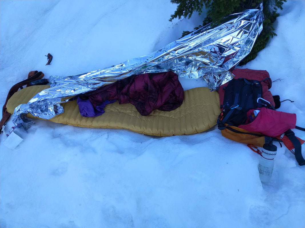 A luxurious campsite. I got up at dawn really needing to pee and feeling surprisingly refreshed after less than 3 hours of sleep. However I made the critical error of simply sleeping in my ski boots, which became apparent as soon as I tried to stand up - sharp pains in my foot caused me to instinctively shift my weight to my other foot, which complained equally, causing me to fall over. In a flailing attempt I tried to "save it" by grabbing my ski pole and pulled a muscle in my left arm. Collecting myself I got up more slowly and "warmed up" my feet to the idea of bearing weight more slowly. They complained, but I applied my time-tested strategy of doing it anyway, and my body got going. I started skiing down towards the Eanastick Meadows only to realize that I maybe wasn't going to be able to cross the outflow from Mamquam lower down so I went back up and crossed over on the still-mostly-frozen lake. 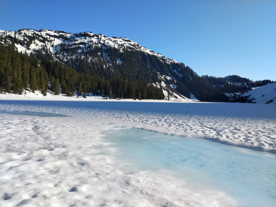 Mamquam Lake was still mostly frozen - I didn't even need to dip my skis into the submerged snow ring around the edge. 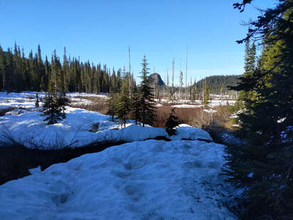 Like many alpine "meadows" Eanastick is more of a swamp, and has lots of meandering streams. Like many alpine "meadows" Eanastick is more of a swamp, and has lots of meandering streams. Despite my aching feet I thought I did pretty good heading over towards the climb up Mamquam - there are a lot of meandering streams and, for the most part, I was able to find easy crossings. The main channel coming down from between Pyramid Mountain and the Mamquam Icefield gave me trouble though - I went up and downstream a ways looking for a good spot but didn't find any bridges on snow or wood. I spent a while staring at the creek and contemplating my options. I had actually brought plastic garbage bags with me for just such an occasion - planning to put them between my ski boot shells and liners. However, with my soaked and aching feet, I didn't want to actually take my boots off because I figured it would be too painful. I brought the bags to keep my feet dry during a stream crossing, but was afraid to use them because my feet were too wet. The irony was not lost on me. Eventually I came up with the idea that I could just put me feet into them, boots and all, and go for it. Sure, I'd probably get some holes, but it seemed unlikely that enough water would flow into them to overtop my boots during a quick crossing. This turned out to work, although it could be noted that garbage bags are also wicked slippery and I was almost knocked over by the force of the water. I should have just used them for all the mushy snow the day before while skiing down from the McBride. 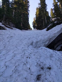 Easy travel nearing the top of the couloir. Easy travel nearing the top of the couloir. After dealing with most of my water-crossing troubles I managed to hit a forested couloir that I'd spotted on google earth while planning the trip and it turned out awesome - shaded and snow-filled it brought me directly to the "nice lake campsite" Baldwin describes in one of his summer traverses through the area (I think). From there I took the "regular route" (if there is one) up towards the lowest col North of Darling Peak to access the upper Mamquam Icefield. As I climbed higher my feet started to complain with more and more urgency. By the time I got to the upper icefield I decided I had to do something other than ignore it - there was still a fair amount of trip left, and I needed my feet to be able to slog out the logging road back to my bike after finishing the skiing portion. One advantage of solo trips is that there's nobody to hear you scream, and I took full advantage of that as I ripped my ski boots off on the upper Mamquam Icefield.  The latest development in primaloft boot liners. The latest development in primaloft boot liners. Investigating my feet made the situation seem a bit grim - they'd absorbed so much water they were wrinkly and looked like a brain. The wrinkles were quite painful to the touch, and I feared that the soles of my feet were staring to delaminate. That wouldn't do - I still had a lot of trip left. I spent about an hour airing out my feet in the sun and trying to dab up the water from the liners with toilet paper (creating some super-gross garbage to pack out in the process). The sun helped a lot on the feet, but the liners weren't getting any better. I contemplated resting there for a few more hours, maybe even sleeping in the sun... Then I had the genius idea to turn my liners inside out. Turns out this is actually possible - as one of my engineering friends (now a prof) used to say: "if brute force doesn't work, just apply more force".  Roasting boot liners. The stench was memorable to say the least. Roasting boot liners. The stench was memorable to say the least. With my puffy jacket and pants stuffed into my shells around my feet as improvised liners and my real liners inverted and stuck on the ends of my ski poles I was off again, simultaneously letting my feet dry out and baking my liners in the hot sun. It worked so well I got all excited and started going for the summit of Mamquam, but when I got up around the corner with Delusion I could see that there was a pretty big Bergschrund so I gave up on that idea. There were some old tracks (first I'd seen on the trip) from some snowshoers who'd come up from the next col to the South and turned around at a similar point. With freshly-dried feet and liners I skied around behind Mamquam (having to gain a bit more elevation than planned due to receding glaciers) and then began the long descent into Bucklin Creek. Overall things went pretty well - I did set off a lot of loose wet snow, but was able to either ski-cut first and then ski down the debris or else quickly sneak across before things really got moving. The Bucklin Creek Valley is actually a really cool place, although the killer suncup problem reappeared and I sometimes took my skis off to just walk. Slogging it out along the flat valley bottom I started dreaming about relaxing in camp, with a real tent and hot food, and drinking the bottle of Kombucha I'd brought for the occasion. Maybe I'd chill it in the Pitt River first... yeah, that would be great. As the snow kept up closer and closer to the road I even started fantasizing that there might be snow on the road and I be able to just cruise a bit of it. 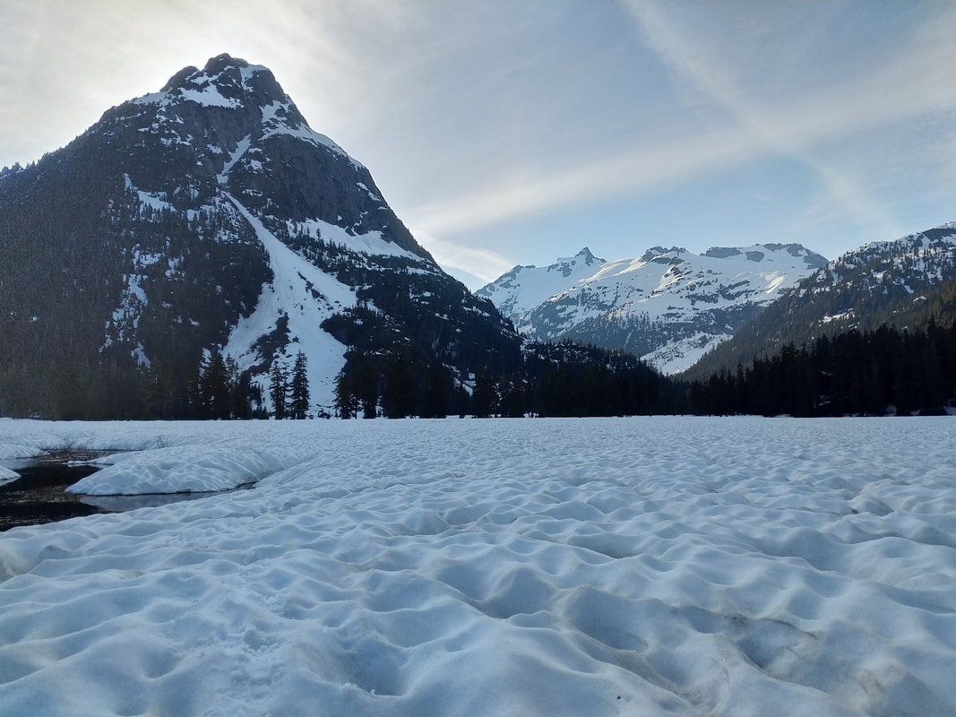 Looking back at Bucklin (left) and Mamquam (right, in distance) from the Bucklin Creek valley.  A cliff band blocked the exit from the valley bottom. A cliff band blocked the exit from the valley bottom. As I got closer to the end of the valley I knew I had to break out on the left so I didn't get drawn down into a canyon, but there was a near-continuous cliff band in the way. After some back and forth I did eventually find a place to scramble up, and found the easier travel I was hoping for on a bench above... however when I finally broke out of the trees above the road, an hour before sunset, I was surprised to find that I was at the top of a cliff hundreds of meters above it and it was looking really overgrown. "That's not good, not good at all" I said to myself.  The "road" looks to be just a strip of different-coloured trees. Another advantage of solo trips is that there's nobody you need to apologize to about major planning screwups.
3 Comments
hoppetosse
7/5/2022 03:16:06 pm
Really fantastic trip report! Cannot wait for part 3 -- incl. chilling at the campsite :)
The fruit of keyboard enthusiasts, often metaphorically referred to, is "Keycaps." Keyboard enthusiasts often customize their mechanical keyboards by replacing keycaps with different colors, designs, and materials to enhance the aesthetic and tactile experience of typing. This practice is known as keycap customization or "keycap sets," and it's a popular aspect of the mechanical keyboard hobby.
I'm not aware of a specific keyboard brand or model called "TOkyo PREss." It's possible that it could be a lesser-known or niche keyboard, and my knowledge only extends up until September 2021, so I may not have information on very recent or obscure products. If "TOkyo PREss" is a newly established brand or a specialized product, you might want to look for information from more up-to-date sources or forums related to keyboards and technology. Leave a Reply. |
Recent tripsMarriott Basin
Alcoholic Traverse Tenquille Lake River of Golden Dreams Desolation Sound Eldred Valley Triple M Triathlon - Misty, McBride, Mamquam Recent tips and thoughtBoxy: Our kid hauling bike
Putting skis on a bike Making a low DIN tech binding What is in our backpacks? The bike canoe trailer Making kids crampons Digging a snowcave Make a kid towing harness Categories
All
|
 RSS Feed